
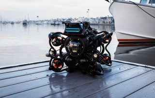
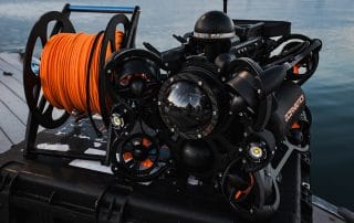
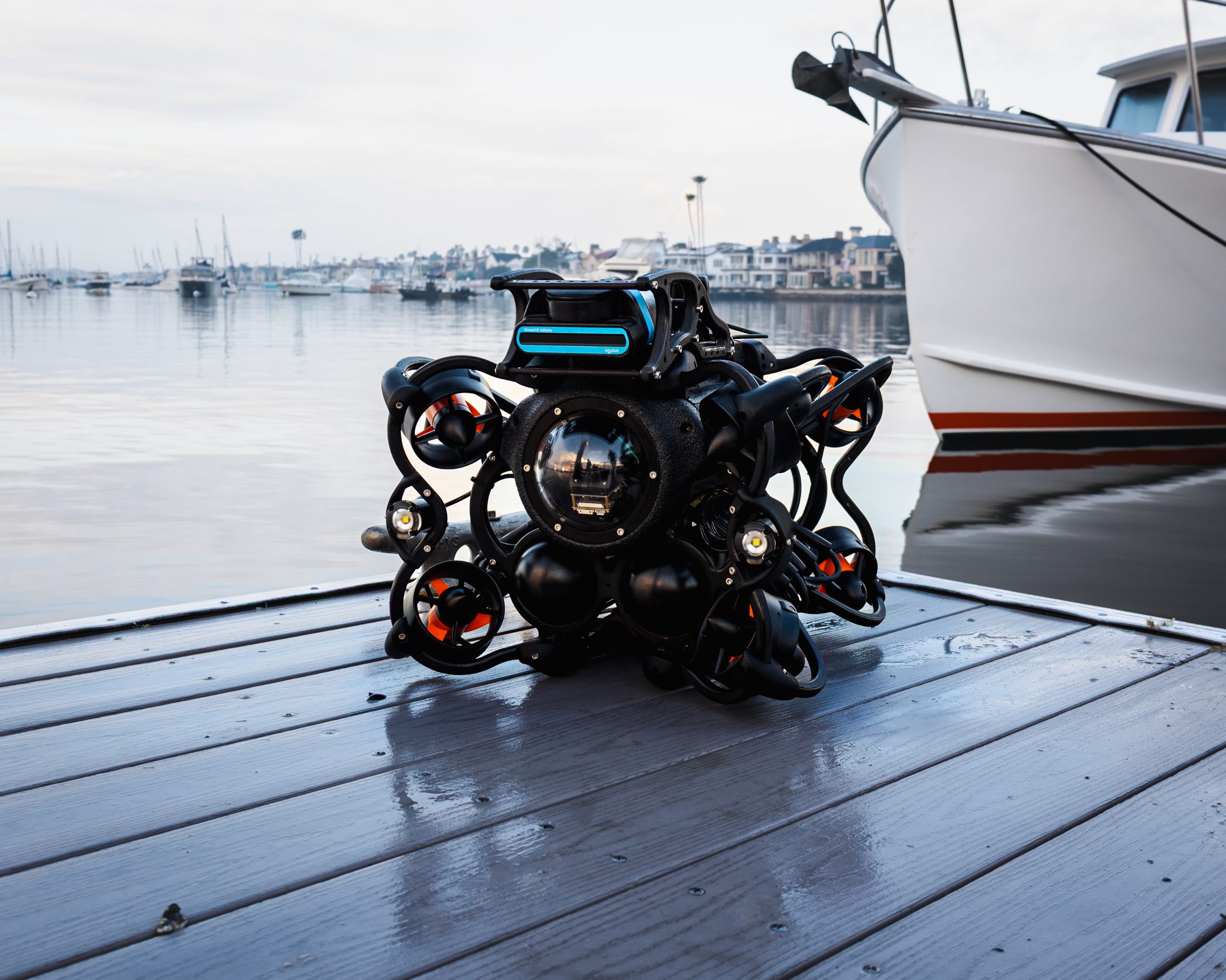
The World’s Most Maneuverable Remotely Operated Vehicles (ROVs)
Fast to Deploy. Easy to Operate.
Experience the Ease of Oceanbotics ROVs:
✅ Mission-Ready in Minutes
✅ Less Time. Less Risk. Less Crew.
✅ Trusted by Professionals Worldwide
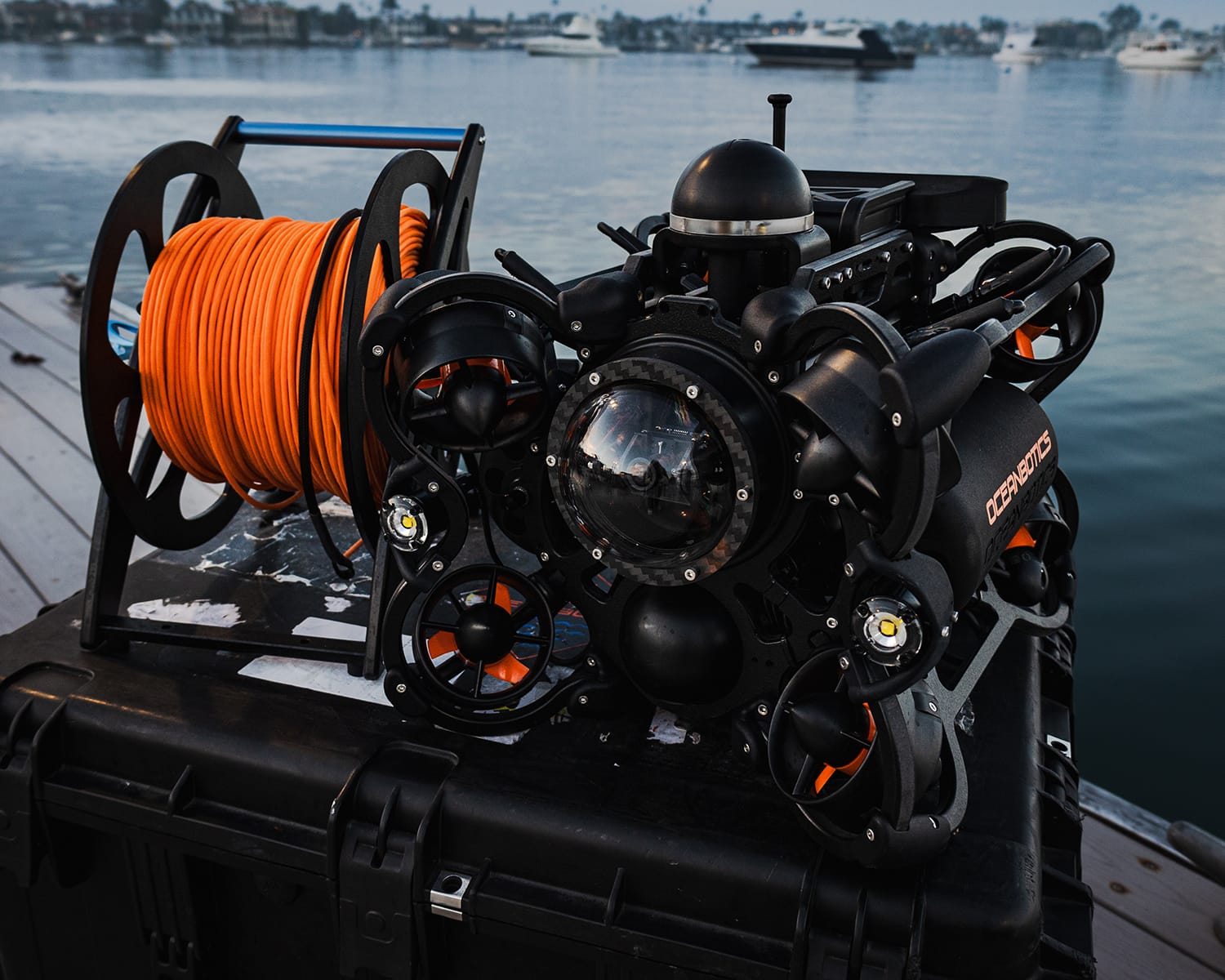
Extreme Maneuverability & Ease of Use
Our ROVs deliver extreme maneuverability with intuitive, easy-to-use controls—perfect for professionals of all experience levels. Learn how to fly the ROV in less than 10 minutes.
Intuituve ROV Software
SubNav OS is powerful, intuitive ROV software designed for professional underwater missions. With a streamlined user interface, real-time data visualization, and simplified navigation tools, SubNav OS makes underwater data collection, inspection, and mission execution faster and easier for any operator.
Quick Deployment for Anyone
Set up and deploy the ROV in less than 3 minutes. Simple controls and user-friendly software make underwater operations more effective for everyone.
Plug & Play Customization for Any Mission
Our ROV software enables true plug-and-play customization—seamlessly connect sonar, USBL, manipulators, and other underwater accessories to build the perfect mission-ready setup.
Industry-Leading Battery Life & Power Options
Experience up to 8 hours of continuous underwater operation with our long-lasting, hot-swappable ROV batteries—designed for quick replacement without shutdown. For extended missions, switch to our Topside Power System (TPS) for a direct, uninterrupted power source. Ideal for demanding underwater inspections, search & rescue, and offshore oil & gas operations.


Customers Who Trust Our ROVs
Our user-friendly Remotely Operated Vehicles (ROVs) are designed to simplify underwater operations, making them more accessible, cost-effective, and highly efficient. Built for ease of use, reliability, and performance in challenging underwater environments.


Testimonials
See what experts in the field are saying about our ROVs.
")
")
")
")
")
")
")
")
")
")
")
")
AS SEEN ON


Tackle Your Toughest Underwater Challenges with a Professional ROV
What’s New at Oceanbotics
NZ Customs ROV Acquisition: Three SRV-8 Units to Combat Drug Smuggling
NZ Customs ROV Acquisition: Three SRV-8 Units to Combat Drug Smuggling IRVINE, CA – In response to increasingly sophisticated maritime smuggling tactics, a new NZ Customs ROV initiative has been announced featuring the acquisition of three advanced SRV-8 Remotely Operated Vehicles. This strategic investment marks a [...]
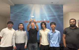
CSUF’s Titan ROV Team Takes 1st Place at National Underwater Robotics Challenge
CSUF’s Titan ROV Team Takes 1st Place at National Underwater Robotics Challenge Students nationwide are gaining hands-on experience in underwater robotics at the year’s premier robot competition: the National Underwater Robotics Challenge (NURC). Hosted by the Firewheel STEM Institute in Chandler, Arizona, NURC highlights robotics for [...]
Introducing the SRV-8C: Compact, Capable & Cost-Effective ROV
Introducing the SRV-8C: Compact, Capable & Cost-Effective ROV It’s finally here—the SRV-8C. The most compact remotely operated vehicle (ROV) in the Oceanbotics lineup, the SRV-8C delivers the same ease of operation, extreme maneuverability, and intuitive SubNav OS software the SRV-8 Series is known for—now in a streamlined, [...]


Let’s Find the Right ROV for You.
Need a free quote? Fill out the form, and our sales team will get in touch promptly.